


Field research now produces torrents of data—thousands of camera trap photos, hours of audio, and streams of sensor readings. This deluge exceeds the capacity of traditional lab workflows, where weeks once sufficed to process a season’s records. Today, decisions on habitat protection, species monitoring, and conservation policy depend on faster, reproducible results drawn from far larger archives.
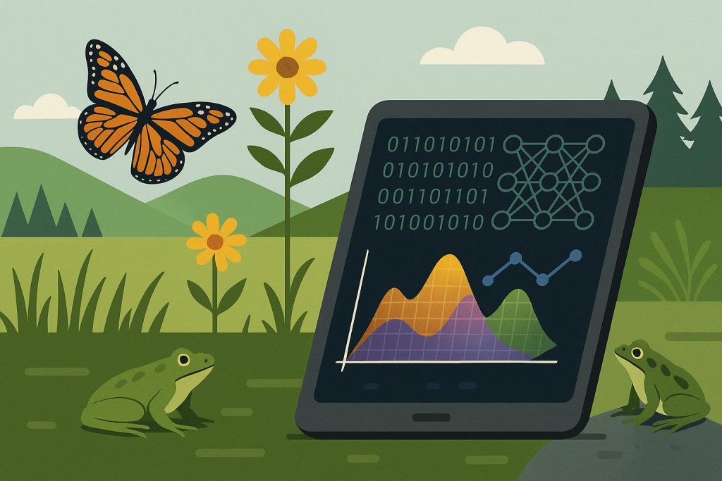
Machine learning offers a way forward. Rather than drowning in raw files, researchers can lean on models to highlight species detections, compress clutter into meaningful patterns, and expose ecological signals hidden in noise. Such methods strengthen rather than replace field expertise, extending its reach by linking evidence directly to conservation planning, restoration priorities, and on-the-ground management.
Reducing Manual Sorting Through AI Trail Camera Workflows
Contents
Thousands of frames from trail cameras arrive filled with shadows, blurred motion, and vegetation stirred by wind. Sorting these manually eats time and storage, often delaying the review of meaningful wildlife captures. With an AI trail camera workflow, automated classifiers cut through this noise by filtering empty images, ranking likely detections, and applying blur thresholds, allowing researchers to focus on moments that actually hold biological value.
Such streamlined pipelines not only reduce storage and computing costs but also preserve data integrity through built-in checks. Weekly audits of a small, random sample highlight errors, refine thresholds, and maintain confidence in results. With compact, labeled batches prepared for expert review, biologists spend less time correcting clutter and more time interpreting ecological patterns.
Documenting Machine Learning Processes for Scientific Rigor
Trust in ecological findings rests on the ability to reproduce and verify analyses. Every model release should carry a clear audit trail that records version numbers, dataset origins, preprocessing steps, hyperparameters, and computing environment. Label mappings tied to recognized taxonomy sources, stored in machine-readable formats like JSON or CSV, prevent ambiguity and keep datasets consistent across teams.
Equally important is linking outputs to raw files through checksums, timestamps, and geotags, while preserving lineage in version control systems. Validation sets, confusion matrices, and threshold records clarify how each model performed. A structured manifest with dataset DOI, commit hash, and label mapping turns otherwise opaque workflows into transparent, auditable science.
Linking Outputs to Habitat and Temporal Contexts
Field detections gain meaning once they are tied to the habitat where animals move. Overlaying data on land cover, elevation, and distance to water reveals habitat preferences, while boundaries and road buffers expose pressures that shape activity. Metrics such as forest percentage within a buffer or elevation range provide predictors that make occupancy and suitability models more grounded in ecological reality.
Time adds another key dimension. Aligning detections with dawn, dusk, or nocturnal cycles shows when species are most active, and seasonal comparisons expose shifts in behavior linked to human activity or environmental change. Recording timestamps in UTC with clear metadata keeps these diel patterns aligned across sites, producing consistent temporal signals that strengthen habitat interpretations.
Coordinating Multi-Site Research Through Centralized Platforms
Research teams spread across regions often operate on disconnected drives and email threads, which fragments tasks. Centralized platforms replace scattered folders with a shared repository, project hierarchies, and metadata templates. Role-based access and read/write audits keep contributions tidy while API endpoints let analysts pull agreed datasets for batch processing.
Version histories record edits, label changes, and checksums, making image provenance auditable. Threaded comments tied to file IDs, in-app task assignments, and digest notifications cut down long email chains and clarify reviewer intent. A practical habit is tagging images with project, site, reviewer IDs and keeping numbered revisions so rollbacks remain straightforward.
Converting Processed Data Into Direct Conservation Actions
Processed datasets hold little value until they are distilled into tools that guide conservation decisions. Dashboards mapping occupancy trends and habitat suitability turn raw numbers into spatial stories, highlighting where species decline or stability occurs. Verified estimates set monitoring cadence: intensify surveys where occupancy drops sharply, scale back where populations remain stable, and direct scarce teams to zones of rapid change.
Concise policy briefs translate outputs into action. A one-page map paired with three core metrics—occupancy, trend, and uncertainty—anchors recommendations in evidence. Linking threshold-based triggers to clear actions allows managers to respond quickly—adjusting surveys, prioritizing restoration, or activating temporary protections in sensitive habitats.
Records once dismissed as overwhelming clutter can now become the backbone of conservation insight. When images, sensor streams, and audio logs are distilled into reliable patterns, researchers shift their focus from sifting noise to understanding ecosystems. Transparent pipelines secure reproducibility, while centralized platforms and habitat-linked outputs keep results grounded in context. Conservation depends on timely action without losing scientific rigor. Adopting auditable models, structured metadata, and concise briefs turns raw data into clear signals that guide habitat restoration, policy direction, and urgent field responses. Practical steps taken today create measurable safeguards for biodiversity in the seasons ahead.