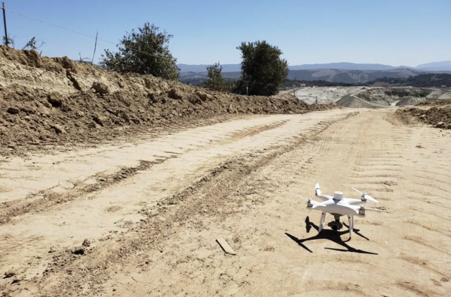
Earthworks teams around the world are discovering new efficiencies by taking to the skies with drones. Drone surveying is quickly becoming an industry standard in the civil construction and earthworks industries, due to its ease of use, incredible accuracy, and positive effects on worker safety and environmental sustainability, among many other benefits. All it takes is a drone, UAV ground control points, and the right drone data processing software to streamline day-to-day workflows.
When you’re new to drone surveying, it’s all too easy to focus on the drone itself. While there are plenty of options to choose from, what really matters is investing in the right drone data processing software. You need an all-in-one solution, like Propeller Aero, to do the heavy lifting for you, transforming data collected in-flight into 3D maps and renderings you can use to track progress, measure stockpiles, and verify your teams’ work.
Whether you’re actively looking to implement a drone surveying program for your worksite or you’re simply looking for more information on the benefits of drone survey data, read on to learn what really matters when it comes to drone surveying.
Take flight with the right drone
Contents
Adopting a drone survey program is a major investment. After getting licensed, you need two key components to take to the skies—the right hardware, the drone itself, and the right software, an all-in-one drone data processing solution.
Many companies put too much effort into choosing the right drone, often resulting in an investment that’s expensive and difficult to scale. By focusing on the right criteria, you can make the process of selecting a drone much easier. Generally, there are three categories of drones to choose from: fixed-wing, multi-rotor, and VTOL drones.
Fixed-wing:
These drones are ideal for large worksites. For example, if your worksite is more than 200 hectares (or 500 acres), you can efficiently survey the site with just one fixed-wing drone. These drones feature a high-quality camera that’s capable of achieving survey accuracy within a fraction of an inch.
Multi-rotor:
Also called quadcopters, multi-rotor drones have a central body and several rotors that enable flight and easy maneuverability. If you typically work with smaller worksites, under 500 acres, a multi-rotor drone is ideal. They have high-quality cameras and are typically the most affordable category of drones.
VTOL:
Vertical takeoff and landing (VTOL) drones offer a blended approach, taking off and landing vertically like a multi-rotor drone, but flying like a fixed-wing drone for maximum efficiency. These drones are also a great option for large-scale worksites, and they’re incredibly accurate due to their high-quality camera.
Choosing the right software is critical
How do you know which platform is right for your day-to-day operations? While you can’t implement a drone survey program without a drone, you also can’t do it without the right processing platform. Choosing reliable, easy-to-use software is so important because it’s what makes drone survey data useful. Earthworks teams benefit from turnkey drone data processing solutions like Propeller Aero for a wide range of benefits, including:
Tracking progress with visual timelines
Propeller makes it easy for you to track progress on the jobsite, allowing you to compare estimated to actual onsite volumes all in one central hub. You can also easily upload designs, so you always have a clear picture of the work that remains.
Reducing rework
Rework costs you time, and time is money. With Propeller’s accurate measurement tools, you have quick access to material calculations on the jobsite. All it takes is just a few clicks, and you can visualize and measure your earthwork volumes.
Sharing data easily
Share up-to-date, actionable site survey data easily with all stakeholders involved in a project, from workers on the ground to executives in the office. All involved parties have consistent access to the information they need to make informed decisions that promote safety and sustainability on the jobsite, all while effectively managing costs and productivity.
Drone survey data is making a positive impact upon the day-to-day workflows in the earthworks and civil construction industries, helping businesses around the world work more efficiently, safely, and sustainably. While the drone you choose for surveying is important, you also need to choose your drone data processing platform carefully. Propeller’s turnkey solution makes it easier than ever for you to turn data collected in-flight into accurate 3D site surveys that help you track progress and productivity at any jobsite.


